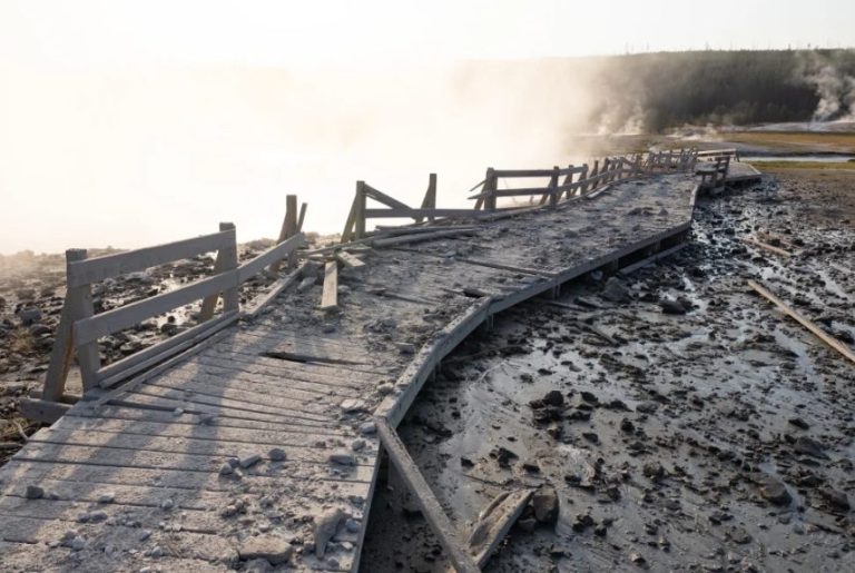
Florida Drought Worsens, Dry and Persistent Fire Conditions Continue With No End In Sight
April 17, 2025 -- 04:25am By: Joe Cantoras // The Blake Moia Show Certified Chief Meteorologist
UPDATED: 04/25/2025 - 7:35PM

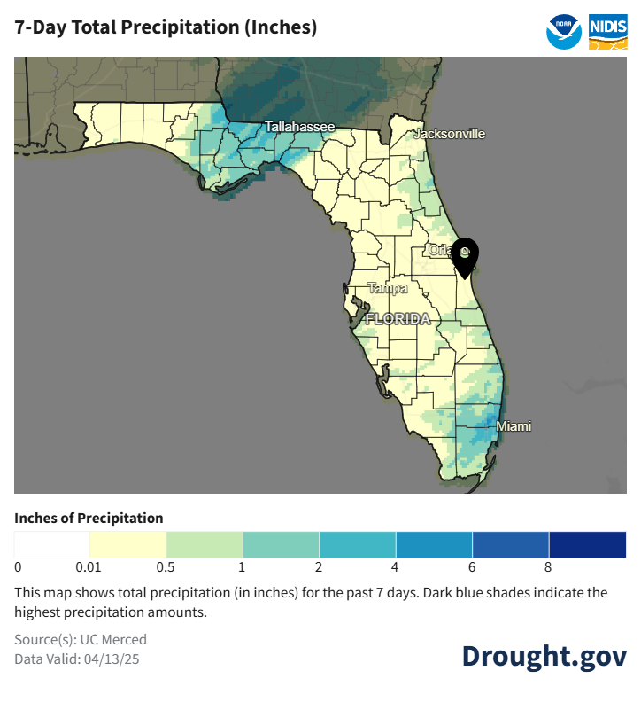
Below normal rainfall has continued over the past month, with moderate (D1) to severe (D2) drought conditions expanding, especially across northern portions of east central Florida.
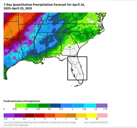
Drier than normal conditions are generally favored through the remainder of spring (through May), which is forecast to allow drought conditions to continue to persist or worsen across the area.
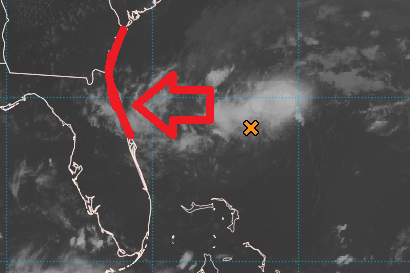
Rainfall forecast is pretty much at zilch.
Drought worsened in portions of northern Lake, Volusia, and Brevard counties.
For much of east central Florida, rainfall has been below normal over the past 90 days, especially near to north of Orlando and across Martin County where precipitation totals have been around 30-60% of normal.
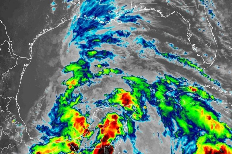
However, periods of locally heavy rainfall, over the past few months, especially south of Orlando during late February, have led to near to above normal rainfall for portions of the Treasure Coast, as well as Osceola and northern Okeechobee counties.
Hydrologic Impacts
The latest 7-day average streamflow indicates an increase in locations reporting values that are below normal (10-24% of normal) to much below normal (<10% of normal), across east central Florida.
Streamflows are decreasing across the region due to continue below normal precipitation.
Values averaged over the past 7 days are below normal (10-24% of normal) from Indian River County northward through Volusia County and are normal (25-75% of normal) farther inland across east central Florida and across the southern Treasure Coast.
Agricultural Impacts
There are no known impacts at this time.
Fire Hazard Impacts
Burn bans are currently in effect for Lake, Volusia, Seminole and Orange counties. Also, due to the drier conditions, the potential for significant wildland fires remains above normal for April, May and June.
Other Impacts
Keetch-Byram Drought Index (KBDI) values have been increasing across the region, with highest values ranging from 500-599 across Lake, Volusia, Seminole, Orange and Martin counties.
Mitigation Actions
Please refer to your municipality and/or water provider for mitigation information.
ORIGINAL ARTICLE:
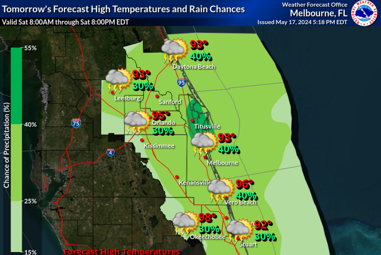
A period of dry, warm weather continues. As high pressure builds into late week, extending across east central Florida.
The minimum RH values fall below critical thresholds across the interior this afternoon ranging 25-35%.
East to northeast winds generally remain less than 10 mph. However, localized winds up to 15 mph will be possible along the sea breeze today. East to southeast winds increase Friday and into the weekend, gusting to 20-25 mph. Onshore flow allows moisture to recover, with min RH values ranging 40-50% Friday and into the weekend.
While criteria for Red Flag is not currently forecast, warm, gusty conditions will continue to promote fire sensitivities across the area. Afternoon temperatures follow a warming trend through late week, ranging the mid to upper 80s across the interior and low 80s along the coast. Generally good smoke dispersion is forecast. Fog potential and other remarks.
Widespread fog is not forecast. Localized visibility reductions due to smoke from new or existing fires will be possible even if fog is not forecast.
THURSDAY...
Sky/weather.........Sunny
Chance of rainfall......0 percent.
Max temperature.....Around 80.
Min humidity........45 percent.
Northeast winds 5 to 10 mph, shifting to the east at 10-15 mph in the afternoon.
Mixing height.......500 ft AGL increasing to 3900-4200 ft AGL in the late morning and afternoon.
Transport winds.....Northeast 10 to 15 mph, shifting to the east in the afternoon.
Dispersion index....7 increasing to 44 in the late morning and afternoon.
Rain throughout the week will be zilch.
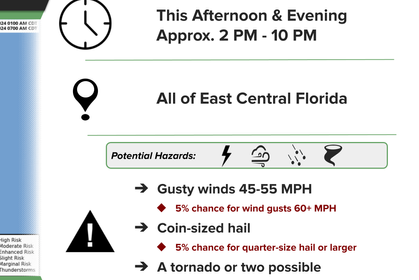
Fire Danger Warning In Effect
Elevated Fire Danger Today Across East Central Florida... Burning outside not recommended.
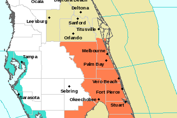
RED FLAG WARNING IN EFFECT UNTIL 7 PM EDT THIS EVENING FOR BREEZY NORTH-NORTHWEST WINDS AND VERY LOW HUMIDITY FOR BREVARD, INDIAN RIVER, OKEECHOBEE, ORANGE, OSCEOLA, SEMINOLE, AND VOLUSIA COUNTIES.
AFFECTED AREA: Brevard, Indian River, Okeechobee, Orange, Osceola, Seminole, and Volusia counties.
WIND: North-northwest around 15 mph with gusts to 20 to 25 mph.
HUMIDITY: 25 to 35 percent.
IMPACTS: Any fires that develop will likely spread rapidly. Outdoor burning is not recommended.
PRECAUTIONARY/PREPAREDNESS ACTIONS: A Red Flag Warning means that critical fire weather conditions are either occurring now; or will shortly. A combination of strong winds...low relative humidity...and warm temperatures can contribute to extreme fire behavior.
MORE WEATHER: THE BLAKE MOIA SHOW 2025 HURRICANE PREDICTION CENTER
HIGH FIRE DANGER

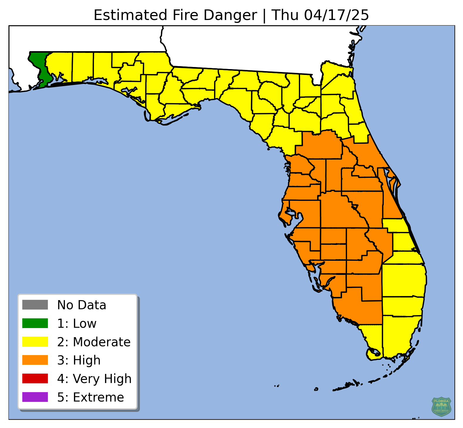
Sensitive to near-critical fire weather conditions are anticipated to persist across east central Florida over the next several days.
An area of high pressure will build across the southeastern U.S. and drift eastward out towards the western Atlantic, where it will then slowly drift southwards towards the local Florida waters. This will keep conditions dry locally, with no rain forecast across east central Florida through the weekend and into early next week. The lack of rainfall will allow for continued drying of fuels.
There is the potential for the return of rain chances during the middle of next week, but there is too much discrepancy between models at this time to be confident.
Critically low RH values are anticipated to continue into Thursday, with values falling into the 25 to 35 percent range across much of the interior and 35 to 50 percent along the coast. RH values improve slightly to 35 to 50 percent on Friday across all of east central Florida and remain generally in that range through the weekend and into Monday.
Onshore winds Thursday through Saturday veer southeasterly Sunday through Tuesday. Wind speeds are anticipated to remain below 15 mph, though local enhancements from the east coast sea breeze each afternoon could cause winds to reach 15 mph and greater.
Gusts to 20 mph cannot be ruled out, especially along the coast. Days with greater wind speeds will likely have higher dispersions, which could lead to control concerns for any active or new fires. Proper fire safety precautions are strongly encouraged over the next several days due to the sensitive to near-critical fire weather conditions.
THE BLAKE MOIA SHOW WEATHER ARCHIVES


©Copyright 2024. All rights reserved. The Blake Moia Show. Privacy Policy
We need your consent to load the translations
We use a third-party service to translate the website content that may collect data about your activity. Please review the details in the privacy policy and accept the service to view the translations.