Tropical Storm Milton Expected to Hit Florida as A MAJOR Hurricane.
Oct. 6th, 2024 -- 1am: By: The Underground Meteorologist -- The Blake Moia Show
Major Hurricane in the Makings
MELBOURNE, FLORIDA --
The National Hurricane Center (NHC) and local meteorologists are urging everyone to pay attention to the forecasts this weekend.
Meteorologists and computer models indicate that all eyes should be on the Tampa Bay, Central and South Florida area. Models are predicting upwards to a foot of rainfall in the Brevard County area next week.
An area of low-pressure in the Western Gulf of Mexico has formed into a tropical storm, according to the NHC. That area of low-pressure will eventually form into a hurricane and get caught up with the steering currents where are going east, towards Florida.
Interests and residences in the Florida peninsula should take action to prepare for the storm. Govenor Ron DeSantis has already issued an Emergency Declaration ahead of the hurricane's arrival.
The Blake Moia Show has a list of available sandbag locations throughout the state. We have reached out to a number of Brevard County Officials and have not heard back from anyone as of this writing.
Expect Tropical Storm Watches and Warnings as well as Hurricane Watches and Warnings within the coming days.
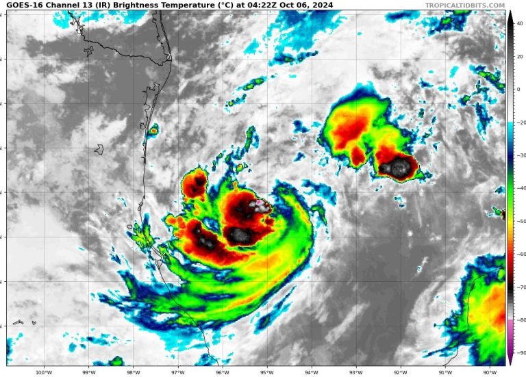
Current IR Image
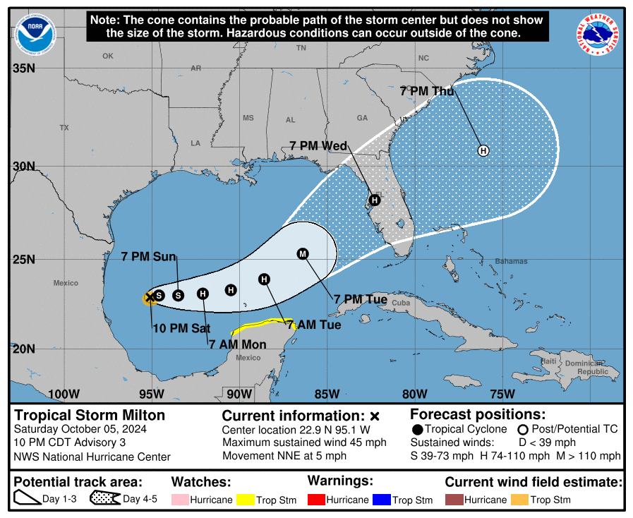
"...MILTON EXPECTED TO STRENGTHEN QUICKLY... ...RISK OF LIFE-THREATENING IMPACTS INCREASING FOR PORTIONS OF THE FLORIDA WEST COAST..."
- LOCATION...22.9N 95.1W
- ABOUT 365 MILES WNW OF PROGRESO MEXICO
- ABOUT 860 MI WSW OF TAMPA FLORIDA
- MAXIMUM SUSTAINED WINDS...45 MPH
- PRESENT MOVEMENT...NNE OR 25 DEGREES AT 5 MPH
- MINIMUM CENTRAL PRESSURE...1005 MB...29.68 INCHES
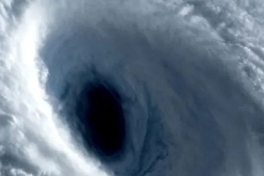
Video Courtesy of TropicalTidbits.com
Milton is moving toward the north-northeast near 5 mph (7 km/h). An eastward to east-northeastward motion is forecast during the next couple of days, followed by a faster northeastward motion.
On the forecast track, Milton is forecast to move across the Gulf of Mexico and approach the west coast of the Florida Peninsula by midweek.
Maximum sustained winds have increased to near 45 mph (75 km/h) with higher gusts. Steady to rapid strengthening is forecast during the next few days.
Milton is forecast to become a hurricane Sunday night, and it could become a major hurricane while it moves across the central and eastern Gulf of Mexico.
Currently, Tropical-storm-force winds extend outward up to 35 miles (55 km) from the center. The estimated minimum central pressure is 1005 mb (29.68 inches).
What The National Hurricane Center Says
RAINFALL:
- Rainfall amounts of 5 to 8 inches, with localized totals up to 12 inches, are expected across portions of the Florida Peninsula and the Keys through Wednesday night.
- This rainfall brings the risk of flash, urban, and areal flooding, along with minor to moderate river flooding. The system may also produce rainfall of 2 to 4 inches across portions of the northern Yucatan Peninsula and western Cuba.
WIND:
- Tropical storm conditions are possible in the Tropical Storm Watch area in the Yucatan Peninsula Monday night and Tuesday.
SURF:
- Swells generated by the system will begin to affect the coast of the southwestern Gulf of Mexico today. These swells are expected to spread northward and eastward along much of the Gulf Coast by early next week and could cause life-threatening surf and rip current conditions. Please consult products from your local weather office.
Key Messages:
- 1. Milton is forecast to quickly intensify while it moves eastward to northeastward across the Gulf of Mexico and be at or near major hurricane strength when it reaches the west coast of the Florida Peninsula mid-week. Hurricane Watches could be issued as early as late Sunday for portions of Florida.
- 2. There is an increasing risk of life-threatening storm surge and wind impacts for portions of the west coast of the Florida Peninsula beginning late Tuesday or Wednesday. Residents in these areas should ensure they have their hurricane plan in place, follow any advice given by local officials, and check back for updates to the forecast.
- 3. Areas of heavy rainfall will impact portions of Florida Sunday and Monday well ahead of Milton, with heavy rainfall more directly related to the system expected later on Tuesday through Wednesday night. This rainfall brings the risk of flash, urban, and areal flooding, along with minor to moderate river flooding.
FROM THE BLAKE MOIA SHOW ARCHIVES
©Copyright 2024. All rights reserved. The Blake Moia Show. Privacy Policy
We need your consent to load the translations
We use a third-party service to translate the website content that may collect data about your activity. Please review the details in the privacy policy and accept the service to view the translations.
